


How to Use This List
Banff National Park has more than 1,600 km of maintained trails, according to Parks Canada. The routes below are grouped by area and rough difficulty, and all distances and elevation gains come from the Parks Canada hiking page. Distances are one way unless marked as a loop, so double them for a return trip.
Trail status in Banff changes often. Bear activity triggers closures and group-access restrictions in summer, and rockfall or construction can shut popular trails at short notice. Check the Parks Canada trail conditions page and bulletins on the morning of your hike, not only when planning.
Short Walks Around Banff Town
- Fenland Loop – 1.9 km loop, 20 m gain. A flat forest walk beside Forty Mile Creek, starting at the Fenland parking area off Mount Norquay Road.
- Tunnel Mountain Summit – 2.3 km one way, 275 m gain. Switchbacks lead to views over the town and the Bow Valley. Start from the lower lot on St. Julien Road (paid parking) or the upper lot on Tunnel Mountain Drive.
- Marsh Trail – 1.5 km one way from Cave and Basin National Historic Site, with a boardwalk over wetlands.
- Surprise Corner to Hoodoos Viewpoint – 4.4 km one way, 115 m gain, following the Bow River below Tunnel Mountain.
In summer, Roam Transit routes reach several of these trailheads, which saves looking for parking in town.
Johnston Canyon: Check Before You Go
Johnston Canyon is normally Banff's busiest trail: 1.1 km to the Lower Falls (85 m gain), 2.4 km to the Upper Falls (215 m), and 5.5 km to the Ink Pots (425 m), a set of coloured springs in an open meadow.
From October 13, 2026, Parks Canada has closed the canyon trail from the main parking lot to both falls for rock slope remediation, and the P1 lot and washrooms are unavailable. The Upper Falls and the Ink Pots can still be reached via the Moose Meadows trail. Separately, a 17 km section of the Bow Valley Parkway east of Johnston Canyon Campground is closed to all travel from 8 p.m. to 8 a.m. between March 1 and June 25 to give wildlife space.
Lake Louise Classics
- Lake Louise Lakeshore – 2.3 km one way, 175 m gain. Easy and popular.
- Fairview Lookout – 1.2 km one way, 100 m gain, looking back over the lake.
- Lake Agnes – 3.9 km one way, 495 m gain, with a seasonal tea house at the top and side trips to the Big and Little Beehives.
- Plain of Six Glaciers – 5.9 km one way, 595 m gain, toward the glaciers at the head of the valley. Combined with Lake Agnes via the Highline Trail, it makes a 14.3 km loop.
Parking at the Lakeshore lot costs $42 per vehicle per day from May 15 to October 12, 2026, and fills early. The Parks Canada shuttle is the usual alternative.
Moraine Lake and Larch Valley
Moraine Lake Road is closed to personal vehicles year-round. Access is by Parks Canada shuttle, licensed commercial operators or as a guest of Moraine Lake Lodge. The shuttle leaves from the Lake Louise Park and Ride at the Lake Louise Ski Resort and runs to Moraine Lake from June 1 to October 12 in 2026. The adult fare is $12.75 plus a $3.50 online reservation fee. Reservations opened April 15, and 60% of seats are released at 8 a.m. MDT two days before each departure.
From the lake:
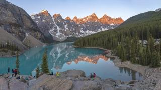
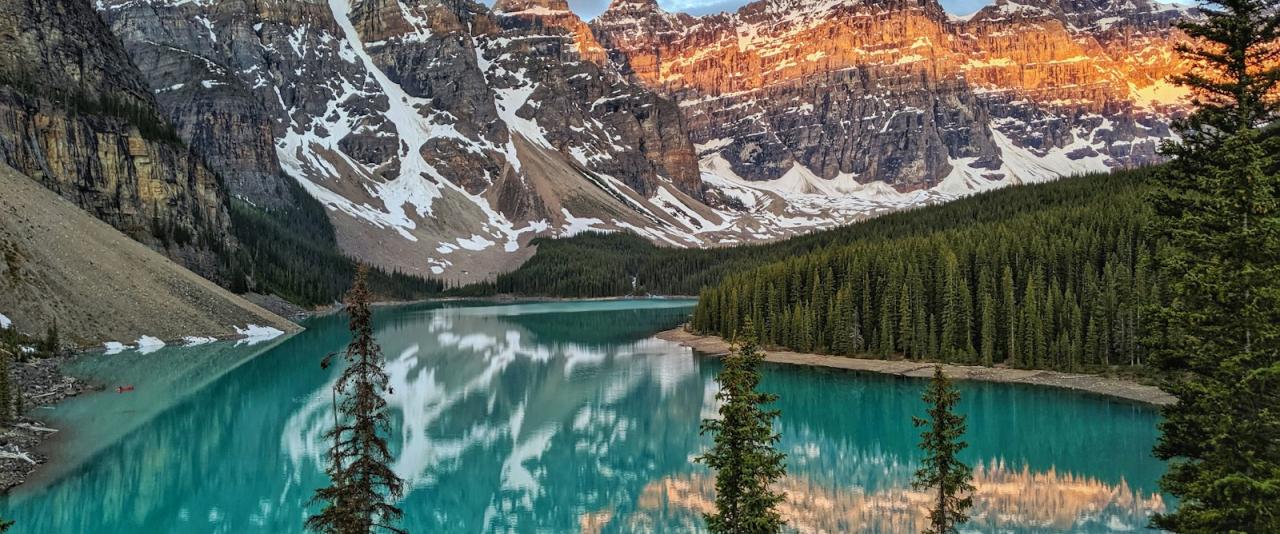
- Rockpile Loop – 0.7 km, for the classic view of the Valley of the Ten Peaks.
- Consolation Lakes – 2.9 km one way, 135 m gain.
- Larch Valley – 4.5 km one way, 570 m gain, busiest when the larches turn gold in late September.
- Sentinel Pass via Larch Valley – 5.6 km one way, 750 m gain.
Bigger Days
For experienced hikers with a full day:
- C-Level Cirque – 3.8 km one way, 440 m gain, past old Bankhead mine workings.
- Sulphur Mountain Trail – 4.8 km to the gondola summit, 655 m gain.
- Bourgeau Lake – 6.7 km one way, 730 m gain.
- Healy Pass – 8.8 km one way, 650 m gain, from the Sunshine Village lot.
- Rockbound Lake – 8.5 km one way, 765 m gain.
- Cory Pass Loop – 11.7 km loop, 930 m gain, steep and exposed in places.
Along the Icefields Parkway, Parker Ridge (2.7 km, 305 m) and Bow Glacier Falls (3.8 km, 95 m) give glacier views for relatively little effort.
Seasons, Safety and Fees
Most higher trails are snow-free only from July to September. Parks Canada says Lake Louise-area trails, Tramline excepted, are exposed to avalanche hazard and does not recommend them from mid-October to mid-June. Trails above about 2,000 m carry avalanche risk especially from November to June.
Carry bear spray and know how to use it, keep dogs on a leash at all times, and give wildlife space. Some areas have seasonal restrictions; the Aylmer area near Lake Minnewanka has a group-access restriction from July 10 to September 15, and parts of the Lake Minnewanka backcountry have been closed since mid-September 2026.
Park entry is required: $12.25 per adult per day, or $83.50 for an adult Parks Canada Discovery Pass valid at national parks across Canada. Youth 17 and under enter free.