





What Gwaii Haanas Is
Gwaii Haanas covers the southern part of Haida Gwaii, the archipelago off the north coast of British Columbia. Its full name is Gwaii Haanas National Park Reserve, National Marine Conservation Area Reserve, and Haida Heritage Site, and it is managed jointly by the Council of the Haida Nation and the Government of Canada through the Archipelago Management Board. The name means "Islands of Beauty" in the Haida language.
The protected area takes in 138 islands, from Moresby Island south to Kunghit Island, and nearly 5,000 square kilometres of land and sea. It was established after the Haida Nation led the effort to stop logging in the area in the 1980s.
A note on expectations: Gwaii Haanas is not a hiking park. There is no "Skyline Trail" here (the well-known Skyline Trails are in Cape Breton Highlands and Jasper national parks). There are no roads and only a few short paths at village sites. A visit is a sea journey, by boat, kayak or floatplane, with short walks ashore.
Reservations and the Mandatory Orientation
Most visitors go with a licensed tour operator, on day trips by zodiac or on multi-day kayak, sailing or motorboat trips. If you travel with an operator, the operator makes your reservation, collects your fees and provides your orientation. Licensed trips book up well in advance.
Independent visitors need their own reservation. Parks Canada opens bookings for each season in mid-February. You submit a reservation form with your entry and exit dates and details for everyone in the group, and staff contact you to confirm and take payment. Book at least five business days ahead, and add spare days for weather.
After payment you receive a link to a self-guided online orientation. It covers closures, emergency procedures, Watchmen sites and how to travel respectfully. Everyone 17 and older must complete it and pass the orientation quiz with at least 80%. You must carry your booking receipt and orientation certificate while in Gwaii Haanas. Save digital copies before you leave, as there is no cell service, and bring a printed copy.
Current listed fees are $29.00 per adult per day for excursion and camping, $24.50 for seniors, with seasonal passes available. Youth 17 and under have free admission, though reservation fees still apply. Check the Parks Canada reservations page for the current year.
Getting to Haida Gwaii
Haida Gwaii is reached by air or by BC Ferries from Prince Rupert to Skidegate on Graham Island, a long crossing of Hecate Strait. Flights from Vancouver serve Sandspit on Moresby Island and Masset on Graham Island. A short ferry links Skidegate and Alliford Bay on Moresby Island.
Gwaii Haanas itself has no road access. Kayakers and small boats usually launch from Moresby Camp, reached by gravel road from the Sandspit side, and travel the sheltered inside passages south. Parks Canada estimates about two days of paddling from Moresby Camp to the northern boundary, weather permitting. Floatplane charters are the other way in.
The Gwaii Haanas office is at the Haida Heritage Centre at Kaay Llnagaay in Skidegate. Visiting the centre before heading south is useful background for the village sites.
Haida Gwaii Watchmen Sites
From May to September, Haida citizens work as Haida Gwaii Watchmen at five ancestral village and cultural sites. Two to four Watchmen live at each site as guardians. The program began in 1981 as a volunteer effort and is now run by the Council of the Haida Nation with support from Parks Canada.
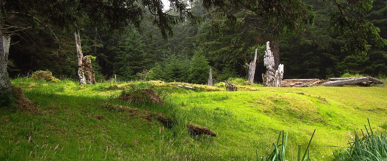
- SGang Gwaay (Anthony Island): the village of SGang Gwaay Llnagaay on the exposed southwest coast, with standing poles and longhouse remains. It was declared a UNESCO World Heritage Site and a National Historic Site in 1981.
- K'uuna Llnagaay (Skedans): on Louise Island, where a few carved poles still stand.
- T'aanuu Llnagaay (Tanu): remains of longhouses and poles are being left to return to the earth, at the direction of the Hereditary Chiefs Council.
- Hlk'yah GawGa (Windy Bay): a site linked to the 1985 logging protests on Lyell Island, where the Legacy Pole was raised in 2013.
- Gandll K'in Gwaay.yaay (Hotspring Island): natural hot springs.
Radio the Watchmen on Marine VHF Channel 6 before you arrive to ask permission to land. No more than 12 people may be ashore at once. Stay on trails, ask before photographing Watchmen, and do not video-record them. Visits must end by 6 pm, with the last group arriving by 4 pm. Camping is not allowed at Watchmen sites, apart from safe harbour at Windy Bay.
Safety and Camping
Gwaii Haanas is remote and rescue may not be quick. A marine VHF radio is essential for weather forecasts, emergencies and contacting Watchmen. Consider a satellite phone or personal locator beacon. There is no fuel anywhere inside the area, and caching fuel or supplies is not allowed.
Weather changes fast, Hecate Strait builds steep waves quickly, and the west coast is exposed and not fully charted. Tidal range can reach 7.5 metres. There are no designated campsites: camp on beaches above the high tide line, stay no more than three nights at one site, hang all food and toiletries away from bears, and keep campfires small and below the high tide line. Drones, caves and shellfish harvesting are off limits.
Planning Checklist
- Decide between a licensed operator and independent travel early.
- Reserve as soon as the season opens and complete the orientation.
- Carry your receipt, orientation certificate, VHF radio and charts.
- Allow spare days for weather on both ends of the trip.
- Check the Gwaii Haanas Important Bulletins page for current closures.